Category:Fulwood, Lancashire
Jump to navigation
Jump to search
English: Fulwood is an unparished area of the City of Preston, England, about north of the city centre. It had a population of 33,171 in 2001. (→Fulwood, Lancashire)
Nederlands: Fulwood is een plaats in het bestuurlijke gebied Preston, in het Engelse graafschap Lancashire met 33.171 inwoners. (→Fulwood)
suburb of Preston, Lancashire, United Kingdom  | |||||
| Upload media | |||||
| Instance of | |||||
|---|---|---|---|---|---|
| Location | Preston, Lancashire, North West England, England | ||||
 | |||||
Subcategories
This category has the following 2 subcategories, out of 2 total.
C
R
- Royal Preston Hospital (6 F)
Media in category "Fulwood, Lancashire"
The following 41 files are in this category, out of 41 total.
-
 54 Our Lady Edward.jpg 3,070 × 3,071; 1.63 MB
-
 Approach to the A6-M55 junction - geograph.org.uk - 1089355.jpg 640 × 426; 62 KB
-
 Back street - geograph.org.uk - 661344.jpg 640 × 480; 162 KB
-
 Bank House and Motorway - geograph.org.uk - 26712.jpg 640 × 480; 99 KB
-
 Cadleyinpreston.png 509 × 480; 8 KB
-
 Former Royal Garrison pub, Fulwood.JPG 4,608 × 3,456; 3.34 MB
-
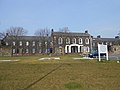
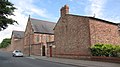
 Former workhouse in Fulwood, Preston - geograph.org.uk - 1723259.jpg 2,592 × 1,944; 1.28 MB
-
 Fulwood Academy, Black Bull Lane, Fulwood (geograph 3139600).jpg 640 × 480; 131 KB
-
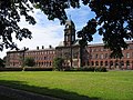
 Fulwood Barracks (1).JPG 4,608 × 3,456; 3.52 MB
-
 Fulwood Barracks (2).JPG 4,608 × 3,456; 3.39 MB
-
 Fulwood Barracks - geograph.org.uk - 137790.jpg 640 × 480; 112 KB
-
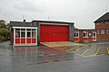 Fulwood fire station - geograph.org.uk - 266749.jpg 640 × 427; 192 KB
-
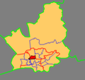
 Fulwood in City of Preston wards 2010.svg 1,187 × 1,305; 327 KB
-
 Fulwood Leisure Centre - geograph.org.uk - 137783.jpg 640 × 480; 92 KB
-
 Fulwood Library - geograph.org.uk - 3575224.jpg 2,510 × 1,559; 2.2 MB
-
 Fulwood Library, on the A6 - geograph.org.uk - 1097708.jpg 640 × 381; 74 KB
-
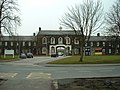
 Hospital and Grounds - geograph.org.uk - 35046.jpg 640 × 480; 83 KB
-
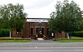
 Lancashire Fire and Rescue Service HQ - geograph.org.uk - 266755.jpg 640 × 427; 228 KB
-
 Lancaster Canal at Cadley - geograph.org.uk - 558003.jpg 640 × 480; 77 KB
-
 Loyal North Lancashire Regiment Cottage Home.JPG 4,608 × 3,456; 3.69 MB
-
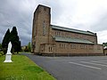 Our Lady ^ St Edward's Catholic Church - geograph.org.uk - 3575239.jpg 2,560 × 1,920; 2.27 MB
-
 Preston and Fulwood in 1950.svg 758 × 492; 54 KB
-
-
 Preston Carmelite Monastery, Fulwood by K A geograph 3016358.jpg 1,920 × 1,080; 724 KB
-
 Preston College, Fulwood Campus - geograph.org.uk - 1200452.jpg 640 × 480; 91 KB
-
 Railway heading north - geograph.org.uk - 3806532.jpg 640 × 480; 100 KB
-
 Shops on Watling Street Road, Fulwood.JPG 4,608 × 3,456; 3.46 MB
-
-
 Bridge over Savick Brook - geograph.org.uk - 137788.jpg 640 × 480; 110 KB
-
 Eastway, Preston - geograph.org.uk - 118357.jpg 640 × 480; 107 KB
-
 Fulwood Free Methodist Church - geograph.org.uk - 27405.jpg 640 × 480; 89 KB
-
 Fulwood Row - geograph.org.uk - 136031.jpg 640 × 480; 93 KB
-
 Ladyewell House, Broughton (Preston) - geograph.org.uk - 538994.jpg 640 × 520; 78 KB
-

-
 Lightfoot Lane, Fulwood - geograph.org.uk - 118354.jpg 640 × 480; 96 KB
-
 Midgery Lane - geograph.org.uk - 27403.jpg 640 × 480; 134 KB
-
 Midgery Lane - geograph.org.uk - 27404.jpg 640 × 480; 169 KB
-
 Orchids by Hindley Hill Woods - geograph.org.uk - 22049.jpg 640 × 480; 143 KB
-

-
 Track in Fulwood - geograph.org.uk - 118356.jpg 640 × 480; 141 KB
-
 Untidy shops in Fulwood - geograph.org.uk - 137791.jpg 640 × 480; 90 KB


.jpg)
.JPG)
.JPG)


_-_geograph.org.uk_-_539045.jpg)


_-_geograph.org.uk_-_538994.jpg)


